We work with state-of-the-art ROV technology, grounding measurement equipment, and ground-penetrating radars. We understand that our clients face demanding challenges, which is why we use the best technology to ensure a precise and reliable service.
With state-of-the-art technology, we can perform precise and reliable inspections to detect potential issues before they cause significant damage.
ROV´S
ROV´S
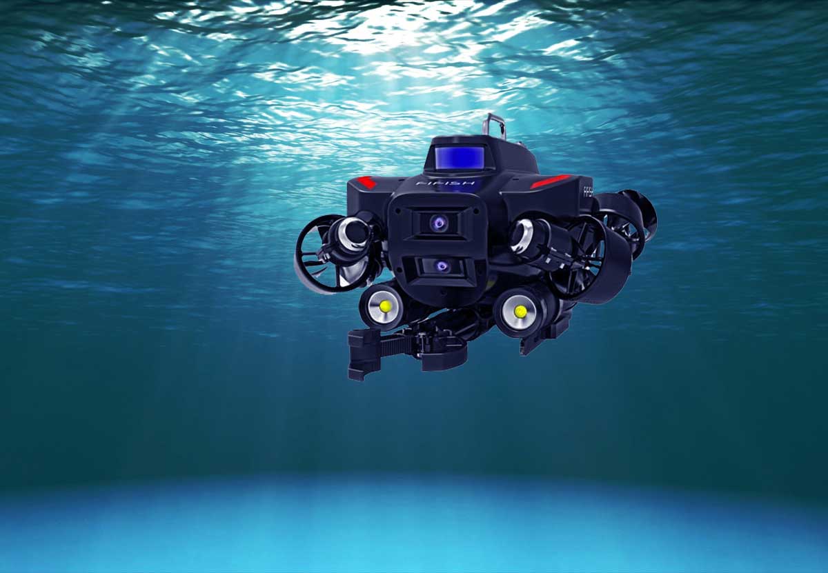
The use of ROVs (Remotely Operated Vehicles) allows us to inspect hard-to-reach places, providing a detailed and precise view of the structure and its surroundings. Our equipment is equipped with laser measuring devices for underwater measurements, dual sonar for millimeter-precise stability, a variety of sampling tools and cameras, and 10,000 lumens of autonomous lighting with HD-4K cameras.
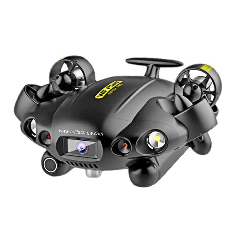
ROV QYSEA Fifish V6 Pro Plus
An expert in advanced underwater solutions. With a diving depth of 150 meters, a remote control charger, an industrial rolling case, spare propellers, and a robotic arm (with additional clamps).
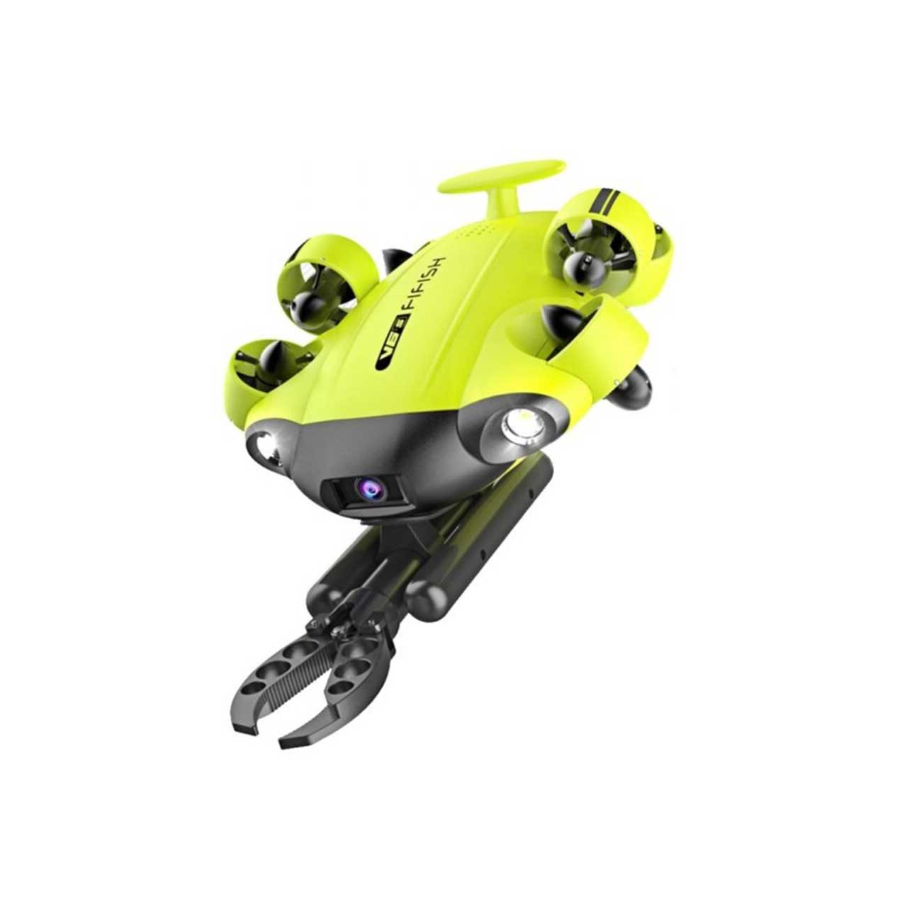
ROV QYSEA Fifish V6
The Fifish QYSEA underwater drone can swim in any direction while recording 4K videos or capturing 12MP photos. It features six thrusters for omnidirectional control and two 2000-lumen lights.
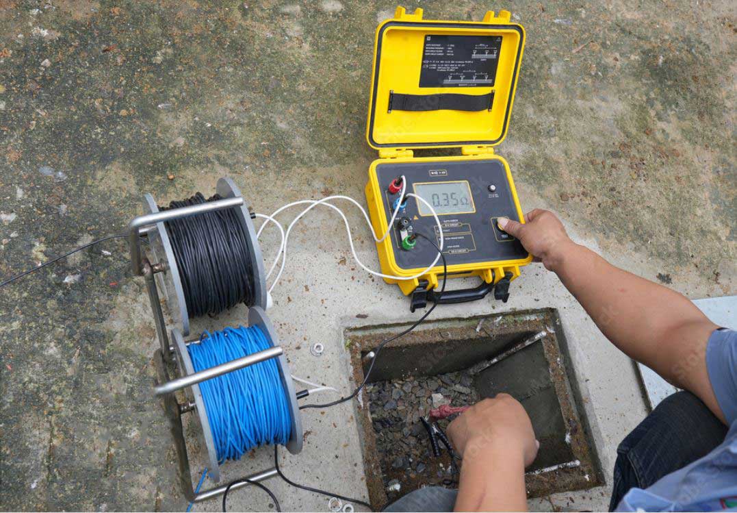
MEASUREMENT AND GROUNDING SYSTEM
MEASUREMENT AND GROUNDING SYSTEM
Grounding measurement allows us to detect electrical issues in subsea structures, which is essential to ensure their safety.
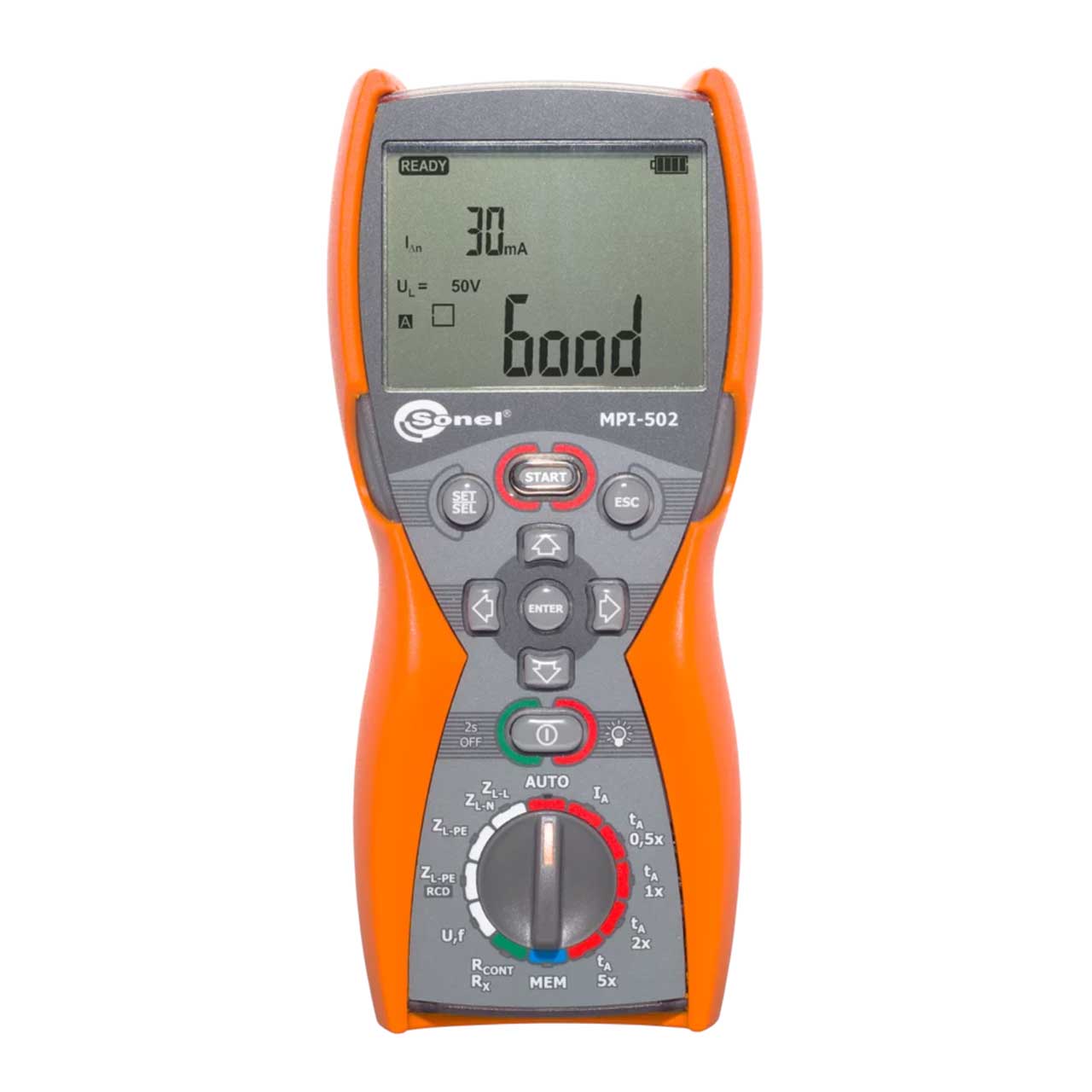
SONEL MPI 502
The Sonel MPI-502 meter is a multifunctional measuring instrument. Despite its compact size, the device offers a wide range of functions and stands out for its ergonomic design and highly durable casing.
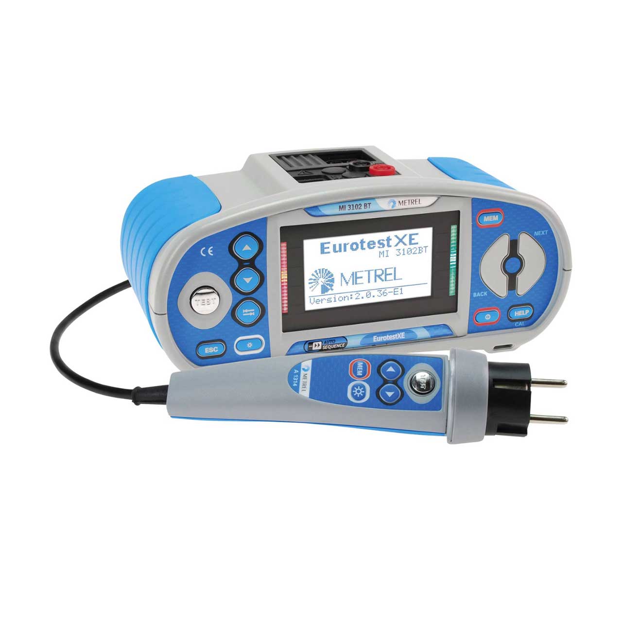
METREL MI 3102
It is a multifunctional measuring device that performs a complete set of installation safety tests according to the IEC/EN 61557 standard. It allows monitoring of line voltage, checking phase sequence, and measuring earth resistance, illuminance, and TRMS current.
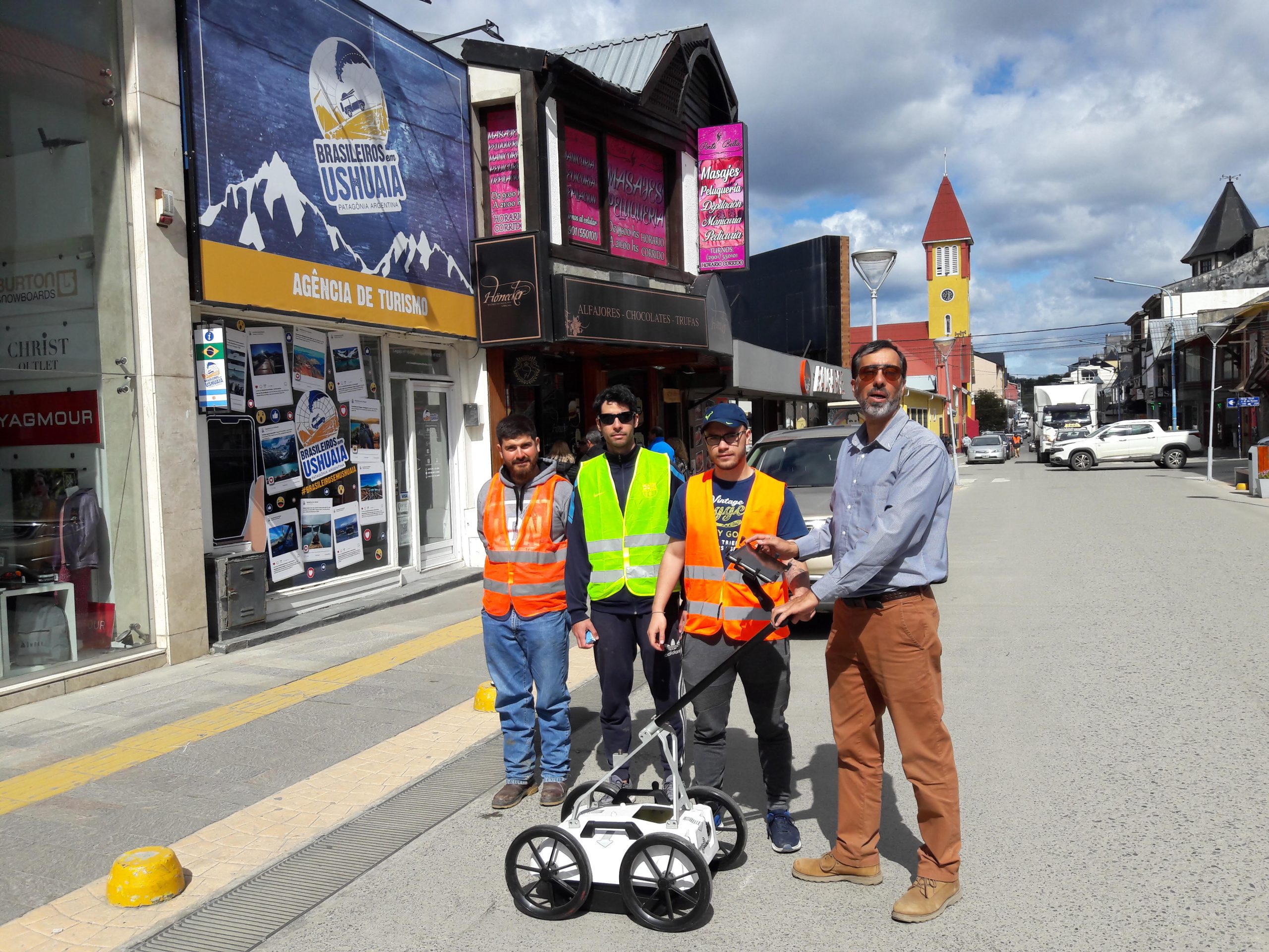
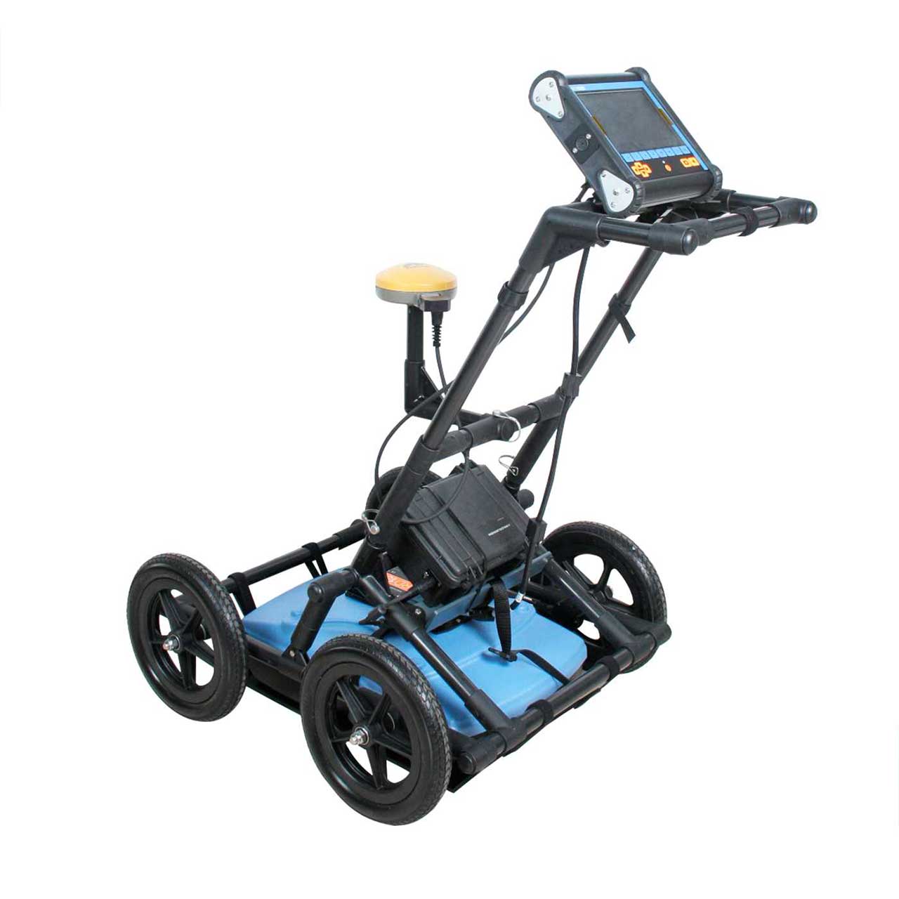
Georadar and Radiodetection
Georadar and Radiodetection
A ground-penetrating radar (GPR) is a geophysical instrument that allows the projection of images of the waves it detects from the subsurface in a non-invasive and non-destructive manner.
IMPULSE RADAR
It locates the position of all types of cables and pipes for marking.
It displays the location of inspections on Google Earth™ and other geo-referencing programs.
It allows the addition of markers via the touchscreen to highlight areas of interest.
No está permitido copiar contenidos de este sitio.
Start chat
1
Do you need help?
Hello, welcome to Deep Water. How can we assist you?